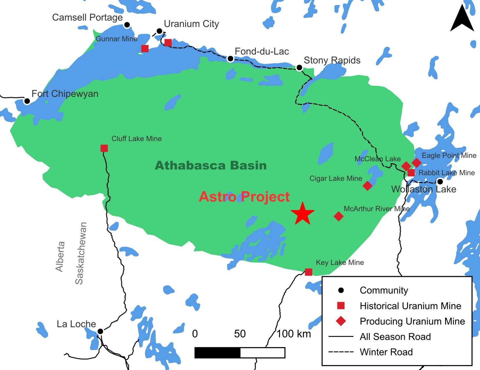
The Astro property is situated 28 kilometers west of the McArthur River Mine, 17 kilometers west of the Fox Lake Deposit, and 13 kilometers north of the Millennium Deposit.
Over 50 years of exploratory data has been compiled across the region, within a proven structural corridor, and close to established roads and power infrastructure in the Athabasca Basin.
Recent ZTEM survey defined seven target zones, with three high-priority conductors interpreted as fault-controlled graphitic zones associated with favorable structures.
Large untested strike length and favorable geology comparable to Tier-1 deposits are now high priority targets for further exploratory testing
Figure 1: The Astro project within the Athabasca Basin, showing regional magnetic signatures and historically identified EM conductors
Astro Project Geology
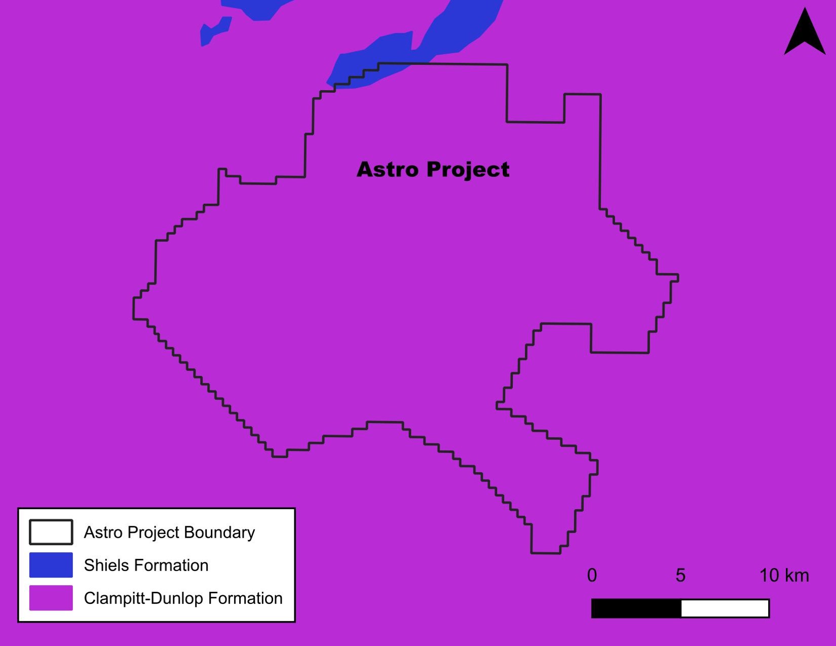
Astro is underlain by subparallel, northwest-trending magnetic lows and highs, interpreted as metasedimentary packages buttressed by granitic intrusions.
The property is strategically located between the Cable Bay Shear Zone and a corridor extending toward the Millennium deposit, both known uranium-bearing structural systems.
The depth to the Athabasca unconformity is estimated at ~750–800 m, consistent with nearby Tier-1 deposits in the eastern Basin.
The Northwest Athabasca Joint Venture is a historical resource with numerous showings and is highly prospective for finding additional high-grade mineralization.
Figure 2: Geological map of the Astro project. Mineralization is being explored for at the unconformity contact
with the crystalline basement below.
Historical Work
Over five decades of surveys, including airborne radiometry, EM, and magnetic surveys, and prospecting. Notable campaigns:
Single diamond drill hole targeting a geophysical signature
2005-2007:
Airborne EM, gradiometric gravity, and ground resistivity surveys.
2010-2012:
Advanced ZTEM and magnetotelluric surveys.
Identified 20 kilometers of EM conductor strike length, with up to 60 kilometers of untested conductive strike potential.
2023:
Partial MMT Coverage Completed by Cosa during surveying at the neighboring Ursa Project.
The Astro Project Recent Work
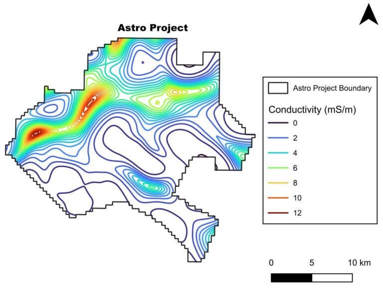
Global and Cosa completed Phase 1 earlier this year, a ZTEM survey across the entire Astro Project (over 450 km²), an advanced airborne sensor capable of detecting basement conductivity beneath the sandstone cover.
The survey uncovered a previously unknown 25 km long conductive corridor (the "Corridor") with an east-west trend, matching the structural orientation of many major deposits in the region.
The discovery of the new corridor will allow Global Uranium to focus future exploration efforts on the most prospective areas of the project, improving resource efficiency and reducing land-holding costs.
The corridor will serve as the backbone for upcoming exploration phases, to refine targets ahead of drill testing.
Figure 3: ZTEM survey across the Astro project. A 25-km long highly conductive corridor runs across
the project from east-to-west; highly prospective for uranium mineralization.
Future Work
Phase 2 | Q2-2026
Complete Ambient Noise Tomography (ANT) survey to generate a 3D seismic velocity model, refining ZTEM anomalies and mapping alteration halos.
Phase 3 | Q4-2026
Conduct ground-based EM surveys to define conductor strength, orientation, and thickness, advancing corridors to drill-ready status.
Phase 4 | Q2-Q3-2027
Integrate ZTEM, ANT, and EM datasets with historical work to prioritize anomalies and optimize drilling efficiency.
Phase 5 | Q4-2027
Execute 3,000 m of diamond drilling to test multiple high-priority targets, focusing on large alteration zones and conductive structures.